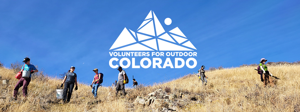
Description
Start Date-End Date: 05/15/2021-05/16/2021
Land Manager Office: BLM - San Luis Valley
Land Manager Contact: Rebecca Fincham
Funding Partner:
Programmatic Partner:
Summary: Celebrate Colorado Public Lands Day by mapping and recording old mine pits and structures for the Bureau of Land Management.
Description: Read Before You Register! Need-to-Know Details:
We greatly appreciate you volunteering your time and energy to care for Colorado's outdoor places during COVID-19. To help provide a fun and safe experience for all, there are a few temporary changes to be prepared for:
You may sign up for one or all days of this project, though we encourage multi-day registration to limit the number of interactions and potential exposure.
You may only register yourself. Every volunteer must sign our digital COVID-specific forms ahead of time to be able to attend.
You must pack your own lunches. Please see below for more information on meals.
You must bring a face mask and work gloves. Please click here for our full packing list of required and recommended items.
Cancellation & Waitlists: Due to limited spots on this year's projects, we expect projects to fill quickly with waitlists. If you need to cancel, please email outreach@voc.org as soon as possible so we can free your spot for another volunteer and have a full workforce. If you are waitlisted for multiple projects, please call us at 303-715-1010 ext. 116 and we can help you find an open project, if available.
Where You'll Be:
The San Luis Valley in southern Colorado is full of natural and cultural history: many residents are descendants of early Spanish settlers and the valley is home to Colorado's oldest town and church, the headwaters of the Rio Grande River, and the stunning San Juan Mountains and Great Sand Dunes. On this project, you'll be in the Los Mogotes hill area west of Antonito; mogotes are steep-sided, often rounded hills usually made of limestone, marble, or dolomite.
What You'll Do:
Celebrate Colorado Public Lands Day and take a walk through Colorado's mining history on this "community science" project for volunteers ages 14+. Throughout the day, we'll be hiking across the landscape in a grid formation to record data on any old mining infrastructure including survey pits or prospector pits, addits, shafts, and more. We'll capture these "Abandoned Mine Land" (AML) features using either a mobile/electronic platform and/or paper forms, capturing a photo of the feature, the GPS location, and other descriptive details to help the Bureau of Land Management (BLM) better manage the area. A BLM geologist will join us to talk more about their work with abandoned mine sites.
Camping is available Friday and Saturday night; VOC's volunteer Crew Chefs will provide breakfast on Saturday and Sunday as well as dinner on Saturday night.
Why It Matters:
The minerals/geology program within the BLM needs to collect AML information in order to properly close or mitigate any potentially hazardous mine features on the landscape, but the data set is nowhere near complete. The data you collect will be a significant help to the BLM in their work to move forward in properly managing these abandoned mine features.
About Volunteers for Outdoor Colorado (VOC)
Volunteers for Outdoor Colorado (VOC) is the state's oldest, largest, and leading outdoor stewardship nonprofit organization. Founded in 1984 to motivate and enable people to become active stewards of Colorado's natural resources, VOC has engaged nearly 126,000 people in more than 1,000 volunteer projects for a donated labor value of $25 million. Through award-winning youth and volunteer programs, leadership training, capacity-building programs, and collaborative efforts with nonprofits and land management agencies, VOC is an invaluable resource in Colorado, especially as our outdoor stewardship needs are approaching near-crisis levels. For more information, visit www.voc.org or call 303-715-1010.
Latitude/Longitude: 38.2007943554, -106.096715159
Additional Information: We greatly appreciate you volunteering your time and energy to care for Colorado's outdoor places during COVID-19. To help provide a fun and safe experience for all, there are a few temporary changes to be prepared for:
You must pack your own lunches.Please see below for more information on meals.
You must bring a face mask and work gloves.Pleaseclick herefor our full packing list of required and recommended items.
Camping is available on both Friday and Saturday night. Please note that VOC doesnotprovide any camping equipment (tents, sleeping bags, etc.) but will providebreakfast on Saturday and Sunday as well as dinner on Saturday night. More information about camping will be sent via email approximately two weeks before the project.
Camping Available: Yes
Physical Difficulty: Moderate
High Altitude Project: Yes
Desired Number of Volunteers: 8
Total Adult Volunteers Attended: 28
Total Youth Volunteers Attended: 0
Total Volunteer Days: 27
Total Unique Volunteers: 14
Total Volunteer Hours: 270
Staff Hours: 50
Stipend Hours: 0
Project Summary: Project site 38.24837353804766, -106.11492374897118 (Off CR LL56 on BLM 4x4 roads 5311,5323)
Camp site 38.2007943554, -106.096715159
Abandoned Mine Mapping Citizen Science at Kerber Creek- May 15-16 2021
Volunteers hiked across huge swaths of BLM land in small groups to survey and record data on abandoned mine land (AML) features for the SLV BLM geology program. Volunteers were joined by Rebecca Fincham, the SLV FO geologist, who was able to discuss mining history, mapping, and geology topics through out the weekend. Day 1 we started at the base of BLM road 5311 and assigned sections of the hillside to each group so we could methodically work through the that gulch. Day 2 we had one group finish up the last of the section from day 1 and then focused on the area off of BLM road 5323.
Surveyed 1070 acres ; recorded a total of 148 mine features.
14 volunteers, 270 hours, on in-kind labor value contributed
Successes and Challenges: Successes:
-?The previous mine mapping project didn'tturn up much and volunteerswere a little discouraged with many leaving after the firstday. This particular site produced a lot of really neat mining features which kept volunteers engaged and excited. It willdefinitelybe helpful to do a more thorough scout to make sure the site has this potential in the future.
-The number of volunteers was perfect for this size site but the additional locations I scouted would benefit from a larger group
-Having the BLM UTV out was very helpful to check in with the different volunteers groups at the work site
Challenges:
-The reporting platform was an issue. iNaturalistwas used in the past but it is very labor intensive for the agency to pull data from and often just sits in the applicationpost project becauseof this. Survery123 makes the data useable in real time and is much preferredby the agency but is difficultto set up for volunteer user access. Rebecca ended up having to put a lot of time and effort into figuring out how to get this set up before the project and it required volunteers to set up accounts prior to the project. It was a complicated processand most volunteers did not get set up prior to the project. Rebecca and I discussed a way to create volunteer user accounts and believeusing this method in the future will be much easier.
-The project site changed a number of times last minute, which was frustrating to have to go out on 3 different scouting projects.
Lessons Learned: Check with USFS fire about prescribed burn locations in the spring when planning project sites to avoid any conflict
Special Notes:
Stewardship Education: Rebecca Fincham gave a presentation on mining in the area and worked with each group in the field to answer questions and examine the geology of the area.
Key Concerns or Comments from Staff or Volunteers: Volunteers seemed to really like this type of project! The citizen science projects provide an alternate volunteer opportunity and have the potential to draw a different type of volunteer interest.
Description of Accidents/Incidents: n/a
Description of Work Completed: See accomplishments tab
Details
| 14 and older |
